
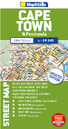
Cape Town & Peninsula Street Map


14 sold in last 1 hour
Hurry! Over 17 people have this in their carts
Estimated Delivery: Thu, Jul 02 – Fri, Jul 03 (Excl Sun)
... people are viewing this right now
Description The Cape Town & Peninsula Street Map is the ideal travel companion to find your way around Cape Town. Coverage includes:- North : Milnerton West : Hout Bay East : Jakes Gerwel (Vanguard Drive) South : Muizenberg Great content which includes a detailed map of Cape Town CBD and Waterfront insert map. The main map is in detailed 1: 25 000 street level scale, which depicts parks and reserves, golf courses, sports fields and stadiums, intersections, route numbers and interchange names. The map also includes places of interest, historical sites and hotels, suburb names and boundaries, schools and sporting venues, industrial areas, wine estates and heritage sites as well as bird sanctuaries and post offices and libaries.